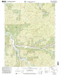
1999 Map of Berryman
USGS Topo · Published 2002About this map
The Mark Twain National Forest dominates this section of the Missouri Ozarks, where the winding Courtois Creek and its many hollows dictate the layout of roads and small settlements. Centered on the community of Berryman at the turn of the 21st century, the map details a landscape managed for recreation and local heritage. Genealogists will find several burial sites including Courtois Cem, Dobkins Cem, and Caswell Cem, along with the Oak Grove Ch. The area is a hub for backcountry travel, featuring both the Ozark Trail and the Berryman Trail, supported by sites like the Berryman Trailcamp. The terrain is characterized by deep drainages such as Henpeck Hollow and Machell Hollow, illustrating the drainage patterns into Brazil Creek and the Lost Creek system near the border of Crawford and Washington Counties.
Find a feature on this map
32 named features on this map. Tap any name to fly to it.
Don’t see what you’re looking for? This feature index may not catch every label — zoom into the map to look around manually.
Map Details
Editions of this 1999 Berryman Map
This is the sole edition of this map. No revisions or reprints were ever made.
Other maps of this area

1901 · De Soto
USGS Topo · 1:125,000

1903 · Sullivan
USGS Topo · 1:125,000

1906 · Potosi
USGS Topo · 1:62,500

1943 · Berryman
USGS Topo · 1:62,500

1945 · Berryman
USGS Topo · 1:62,500

1946 · Richwoods
USGS Topo · 1:62,500

1947 · Sullivan
USGS Topo · 1:62,500

1948 · Richwoods
USGS Topo · 1:62,500

1949 · Saint Louis
USGS Topo · 1:250,000

1949 · Sullivan
USGS Topo · 1:62,500