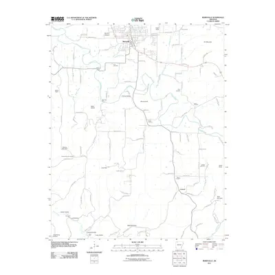
2011 Map of Berryville
USGS Topo · Published 2011About this map
Berryville serves as the primary hub of this northern Arkansas landscape, where the grid of the city meets the winding paths of the Ozark foothills. The area's history is recorded in its numerous family and community burial grounds, including the Berryville Memorial Cemetery, Rush Cemetery, and Briley Cemetery. The terrain is defined by a series of prominent elevations like Pension Mountain and Fort Mountain, alongside numerous hollows such as Farmer Hollow and Kittner Hollow that indicate the deep-seated drainage patterns of the region. Water remains a central element of the topography, with Osage Creek and its many tributaries, including Freeman Branch and Warden Branch, carving through the countryside. Downstream, the Jackson Lake Dam and the smaller settlement of Cabanal illustrate the more rural, agricultural character of the county as it appeared in the early 21st century.
Find a feature on this map
111 named features on this map. Tap any name to fly to it.
Don’t see what you’re looking for? This feature index may not catch every label — zoom into the map to look around manually.
Map Details
Editions of this 2011 Berryville Map
This is the sole edition of this map. No revisions or reprints were ever made.
Other maps of this area

1900 · Eureka Springs
USGS Topo · 1:125,000

1901 · Eureka Springs
USGS Topo · 1:125,000

1904 · Harrison
USGS Topo · 1:125,000

1905 · Harrison
USGS Topo · 1:125,000

1945 · Harrison
USGS Topo · 1:250,000

1949 · Harrison
USGS Topo · 1:250,000

1954 · Harrison
USGS Topo · 1:250,000

1958 · Harrison
USGS Topo · 1:250,000

1964 · Harrison
USGS Topo · 1:250,000
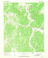
1968 · Osage
USGS Topo · 1:24,000