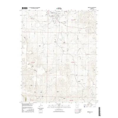
2017 Map of Berryville
USGS Topo · Published 2017About this map
Berryville serves as the focal point of this Northwest Arkansas landscape, where the street grid transitions into a terrain of deeply cut hollows and ridges. The town's historical geography is marked by numerous family and community burial grounds, including the Berryville Memorial Cem and the more remote Rush Cem. To the south, the settlement of Cabanal sits amidst a network of natural watercourses such as Osage Creek and Cedar Cr.
Find a feature on this map
67 named features on this map. Tap any name to fly to it.
Don’t see what you’re looking for? This feature index may not catch every label — zoom into the map to look around manually.
Map Details
Editions of this 2017 Berryville Map
This is the sole edition of this map. No revisions or reprints were ever made.
Other maps of this area

1900 · Eureka Springs
USGS Topo · 1:125,000

1901 · Eureka Springs
USGS Topo · 1:125,000

1904 · Harrison
USGS Topo · 1:125,000

1905 · Harrison
USGS Topo · 1:125,000

1945 · Harrison
USGS Topo · 1:250,000

1949 · Harrison
USGS Topo · 1:250,000

1954 · Harrison
USGS Topo · 1:250,000

1958 · Harrison
USGS Topo · 1:250,000

1964 · Harrison
USGS Topo · 1:250,000
1968 · Osage
USGS Topo · 1:24,000