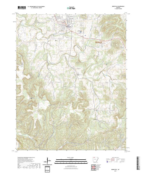
2024 Map of Berryville
USGS Topo · Published 2024About this map
Berryville serves as the regional anchor of this Carroll County landscape, defined by its historic County Courthouse and a network of neighborhood streets like Eureka Ave and S Main St. The terrain transitions from the urban center into the Ozark highlands, where the Kings River and Osage Creek carve through numerous hollows. The area is dense with small, family-named burial grounds, including Rush Cem, Moore Cem, and Pension Mountain Cem, offering significant value for genealogical research. Prominent local landmarks such as Pension Mtn and Anderson Mt overlook a landscape of winding country roads and isolated settlements like Cabanal. This layout reflects a long-standing pattern of ridge-top navigation and creek-bottom farming common to the Arkansas Ozarks.
Find a feature on this map
103 named features on this map. Tap any name to fly to it.
Don’t see what you’re looking for? This feature index may not catch every label — zoom into the map to look around manually.
Map Details
Editions of this 2024 Berryville Map
This is the sole edition of this map. No revisions or reprints were ever made.
Other maps of this area

1900 · Eureka Springs
USGS Topo · 1:125,000

1901 · Eureka Springs
USGS Topo · 1:125,000

1904 · Harrison
USGS Topo · 1:125,000

1905 · Harrison
USGS Topo · 1:125,000

1945 · Harrison
USGS Topo · 1:250,000

1949 · Harrison
USGS Topo · 1:250,000

1954 · Harrison
USGS Topo · 1:250,000

1958 · Harrison
USGS Topo · 1:250,000

1964 · Harrison
USGS Topo · 1:250,000
1968 · Osage
USGS Topo · 1:24,000