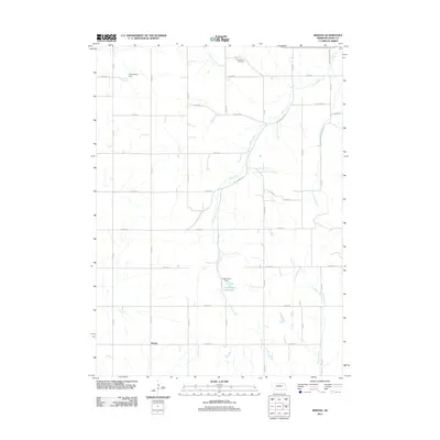
2011 Map of Bertha
USGS Topo · Published 2011About this map
Bertha is the central point of this agricultural landscape in Burt County, which was surveyed during a time of modern rural development in eastern Nebraska. The area is defined by a grid of county roads and the presence of localized water management, including the Drummond Dam and Langemeier Dam which create small reservoirs for local land use. The map illustrates how the natural drainages of Elm Creek, Lone Tree Creek, and Silver Creek intersect with the rigid township and range road network. To the north, the Holy Family Cemetery stands as a focal point for genealogical interest, while the path of Old Highway 118 reveals the evolution of transport through this section of the state. This map provides a clear record of land ownership patterns and local infrastructure in the early 21st century.
Find a feature on this map
30 named features on this map. Tap any name to fly to it.
Don’t see what you’re looking for? This feature index may not catch every label — zoom into the map to look around manually.
Map Details
Editions of this 2011 Bertha Map
This is the sole edition of this map. No revisions or reprints were ever made.
Other maps of this area

1955 · Sioux City
USGS Topo · 1:250,000

1955 · Fremont
USGS Topo · 1:250,000

1957 · Fremont
USGS Topo · 1:250,000

1958 · Sioux City
USGS Topo · 1:250,000

1958 · Fremont
USGS Topo · 1:250,000

1959 · Sioux City
USGS Topo · 1:250,000

1966 · Oakland
USGS Topo · 1:24,000

1966 · Lyons
USGS Topo · 1:24,000

1966 · Walthill SW
USGS Topo · 1:24,000

1966 · Macy
USGS Topo · 1:24,000