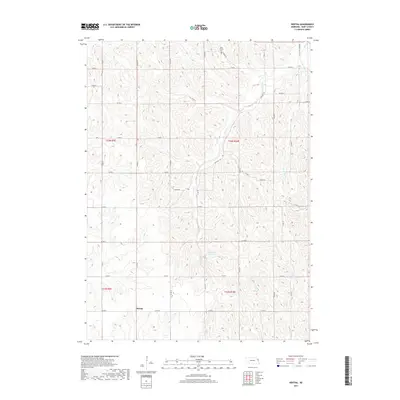
2017 Map of Bertha
USGS Topo · Published 2017About this map
The unincorporated community of Bertha anchors this portion of rural Burt County, situated amidst the dissected uplands of eastern Nebraska. The landscape is defined by a dense network of county roads following the section lines of the Public Land Survey System, including Co Rd 27 and Co Rd O. Water drainage in the area is shaped by several prominent streams, most notably Lone Tree Creek and Elm Creek, which carve intricate patterns through the terrain. Near the northern boundary, the Holy Family Cem serves as a significant local landmark for genealogical research. The presence of the Langemeier Reservoir along Elm Creek indicates the importance of water management in this agricultural region, while Silver Creek flows through the southeastern reaches of the quadrangle.
Find a feature on this map
33 named features on this map. Tap any name to fly to it.
Don’t see what you’re looking for? This feature index may not catch every label — zoom into the map to look around manually.
Map Details
Editions of this 2017 Bertha Map
This is the sole edition of this map. No revisions or reprints were ever made.
Other maps of this area

1955 · Sioux City
USGS Topo · 1:250,000

1955 · Fremont
USGS Topo · 1:250,000

1957 · Fremont
USGS Topo · 1:250,000

1958 · Sioux City
USGS Topo · 1:250,000

1958 · Fremont
USGS Topo · 1:250,000

1959 · Sioux City
USGS Topo · 1:250,000

1966 · Oakland
USGS Topo · 1:24,000

1966 · Lyons
USGS Topo · 1:24,000

1966 · Walthill SW
USGS Topo · 1:24,000

1966 · Macy
USGS Topo · 1:24,000