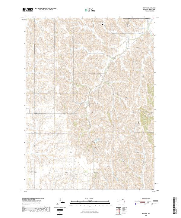
2021 Map of Bertha
USGS Topo · Published 2021About this map
The unincorporated community of Bertha anchors the southern portion of this Burt County landscape, situated amidst a dense network of county roads that follow the section lines of the Public Land Survey System. The terrain is defined by the drainages of Elm Cr, Lone Tree Cr, and Silver Cr, which carve through the loess hills of eastern Nebraska. Human impact is visible through agricultural infrastructure, most notably at the Langemeier Reservoir and the Holy Family Cem in the northern reaches. The presence of Old Hwy 118 suggests a legacy transport corridor that predates modern highway alignments. This 2021 survey demonstrates the persistent rural character of the region, where land use remains strictly divided by the township and range system, specifically within t23n r9e and surrounding quadrants.
Find a feature on this map
20 named features on this map. Tap any name to fly to it.
Don’t see what you’re looking for? This feature index may not catch every label — zoom into the map to look around manually.
Map Details
Editions of this 2021 Bertha Map
This is the sole edition of this map. No revisions or reprints were ever made.
Other maps of this area

1955 · Sioux City
USGS Topo · 1:250,000

1955 · Fremont
USGS Topo · 1:250,000

1957 · Fremont
USGS Topo · 1:250,000

1958 · Sioux City
USGS Topo · 1:250,000

1958 · Fremont
USGS Topo · 1:250,000

1959 · Sioux City
USGS Topo · 1:250,000

1966 · Oakland
USGS Topo · 1:24,000

1966 · Lyons
USGS Topo · 1:24,000

1966 · Walthill SW
USGS Topo · 1:24,000

1966 · Macy
USGS Topo · 1:24,000