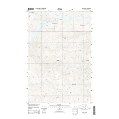
2014 Map of Bertha Hill
USGS Topo · Published 2014About this map
The St. Joe National Forest and Clearwater National Forest converge in this high-elevation corner of Idaho, where the northern reaches of the Bitterroot Mountains meet the waters of Dworshak Reservoir. The landscape is defined by its remote outposts and steep drainage networks, featuring isolated structures such as Larkins Cabin, Carson Cabin, and Larson Cabin. These sites, along with the Larson Bar Landing Area, suggest a history of seasonal access and forest management in a region where travel follows the ridges and saddles between peaks.
Find a feature on this map
46 named features on this map. Tap any name to fly to it.
Don’t see what you’re looking for? This feature index may not catch every label — zoom into the map to look around manually.
Map Details
Editions of this 2014 Bertha Hill Map
This is the sole edition of this map. No revisions or reprints were ever made.
Other maps of this area

1923 · Washington Creek
USGS Topo · 1:125,000

1936 · Boehls Butte
USGS Topo · 1:48,000

1938 · Headquarters
USGS Topo · 1:48,000

1943 · Boehls Butte
USGS Topo · 1:62,500

1944 · Headquarters
USGS Topo · 1:62,500

1956 · Hamilton
USGS Topo · 1:250,000

1959 · Hamilton
USGS Topo · 1:250,000

1960 · Hamilton
USGS Topo · 1:250,000
1963 · Buzzard Roost
USGS Topo · 1:24,000

1964 · Hamilton
USGS Topo · 1:250,000