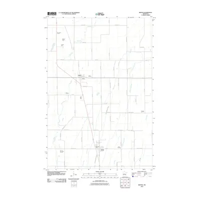
2010 Map of Bertha
USGS Topo · Published 2010About this map
Hewitt and Bertha serve as the primary hubs in this Todd County landscape, connected by a network of rural roads that mirror the orderly sections of the Upper Midwest. The Wing River meanders across the western half of the map, past landmarks like Mount Nebo and the Kramer Dam, while the eastern portion is drained by Bear Creek and the Little Partridge River. This survey reveals a landscape deeply rooted in its local heritage, evidenced by the numerous burial grounds scattered across the townships. Genealogists will find interest in several historic sites, including the Trinity Cemetery, Immanuel Cemetery, and the Zion and Saint Johns Cemetery located near the southern boundary. The infrastructure of the era is marked by specific rural identifiers such as the Hewitt Rest Area and the dual presence of the Hewitt Post Office and Bertha Post Office.
Find a feature on this map
50 named features on this map. Tap any name to fly to it.
Don’t see what you’re looking for? This feature index may not catch every label — zoom into the map to look around manually.
Map Details
Editions of this 2010 Bertha Map
This is the sole edition of this map. No revisions or reprints were ever made.
Other maps of this area

1953 · Brainerd
USGS Topo · 1:250,000

1957 · Brainerd
USGS Topo · 1:250,000

1958 · Brainerd
USGS Topo · 1:250,000

1965 · Brainerd
USGS Topo · 1:250,000

1966 · Aldrich North
USGS Topo · 1:24,000
1966 · Clarissa
USGS Topo · 1:24,000

1966 · Aldrich South
USGS Topo · 1:24,000
1969 · Eagle Bend
USGS Topo · 1:24,000

1969 · Bertha
USGS Topo · 1:24,000

1969 · Wrightstown
USGS Topo · 1:24,000