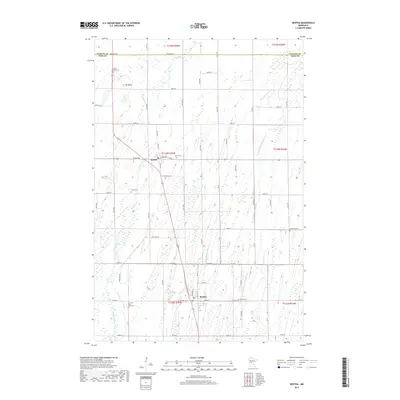
2019 Map of Bertha
USGS Topo · Published 2019About this map
Wing River flows through a landscape of central Minnesota farmland and marshy lowlands where the border of Wadena and Todd counties meets. The small village of Hewitt sits as a central hub, while the town of Bertha anchors the southern portion of the survey. The terrain is marked by the presence of numerous small cemeteries that serve as vital records of early families and local congregations, including Zion and Saint Johns Cem and Mount Nebo Cem, the latter situated near the local high point of Mt Nebo. A network of water management features, such as County Ditch Number Fifteen, suggests the extensive drainage efforts required to reclaim the wet prairie for agriculture. To the east, the Little Partridge River and Bear Cr provide a natural drainage system for the surrounding acreage.
Find a feature on this map
39 named features on this map. Tap any name to fly to it.
Don’t see what you’re looking for? This feature index may not catch every label — zoom into the map to look around manually.
Map Details
Editions of this 2019 Bertha Map
This is the sole edition of this map. No revisions or reprints were ever made.
Other maps of this area

1953 · Brainerd
USGS Topo · 1:250,000

1957 · Brainerd
USGS Topo · 1:250,000

1958 · Brainerd
USGS Topo · 1:250,000

1965 · Brainerd
USGS Topo · 1:250,000

1966 · Aldrich North
USGS Topo · 1:24,000
1966 · Clarissa
USGS Topo · 1:24,000

1966 · Aldrich South
USGS Topo · 1:24,000
1969 · Eagle Bend
USGS Topo · 1:24,000

1969 · Bertha
USGS Topo · 1:24,000

1969 · Wrightstown
USGS Topo · 1:24,000