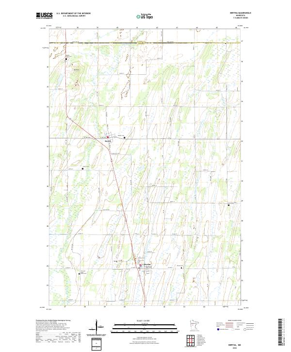
2022 Map of Bertha
USGS Topo · Published 2022About this map
Bertha and Hewitt serve as the primary hubs in this central Minnesota landscape, where the agricultural grid is defined by the winding course of the Wing River and its tributaries. The terrain is marked by notable elevations such as Mt Nebo, which overlooks a series of rural cemeteries that anchor the local heritage. For genealogists, the map is particularly rich in burial sites, ranging from the Mount Nebo Cem in the north to the Zion and Saint Johns Cem and Peace Cem near the southern boundary. The drainage patterns of the region are heavily influenced by the Little Partridge River and the engineered County Ditch Number Fifteen, reflecting a long history of water management to support the surrounding farmland. These features, alongside the network of county roads like Raccoon Rd and Todd Line Rd, illustrate the enduring intersection of natural waterways and rural infrastructure.
Find a feature on this map
42 named features on this map. Tap any name to fly to it.
Don’t see what you’re looking for? This feature index may not catch every label — zoom into the map to look around manually.
Map Details
Editions of this 2022 Bertha Map
This is the sole edition of this map. No revisions or reprints were ever made.
Other maps of this area

1953 · Brainerd
USGS Topo · 1:250,000

1957 · Brainerd
USGS Topo · 1:250,000

1958 · Brainerd
USGS Topo · 1:250,000

1965 · Brainerd
USGS Topo · 1:250,000

1966 · Aldrich North
USGS Topo · 1:24,000
1966 · Clarissa
USGS Topo · 1:24,000

1966 · Aldrich South
USGS Topo · 1:24,000
1969 · Eagle Bend
USGS Topo · 1:24,000

1969 · Bertha
USGS Topo · 1:24,000

1969 · Wrightstown
USGS Topo · 1:24,000