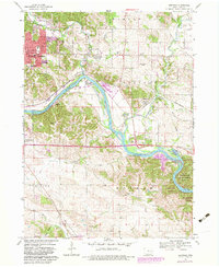
1968 Map of Bertram
USGS Topo · Published 1983About this map
The Cedar River carves a sweeping path through this portion of Linn County, shaping a landscape defined by its riparian bends and the convergence of Indian Creek and Squaw Creek. The southeastern corridor is dominated by the extensive Palisades-Kepler State Park and the adjacent Palisades Dows Preserve, areas that protect the bluffs and wooded terrain overlooking the river. To the northwest, the expansion of Cedar Rapids is visible through suburban developments like Vernon View and Worthington Acres, while the historic Chicago and North Western Railroad Grade and the Indian and Fox Trail trace older transportation routes through the river valley.
Find a feature on this map
46 named features on this map. Tap any name to fly to it.
Don’t see what you’re looking for? This feature index may not catch every label — zoom into the map to look around manually.
Map Details
Editions of this 1968 Bertram Map
Other maps of this area

1887 · Cedar Rapids
USGS Topo · 1:62,500

1888 · Marion
USGS Topo · 1:62,500

1889 · Marion
USGS Topo · 1:62,500

1890 · Anamosa
USGS Topo · 1:62,500

1891 · Mechanicsville
USGS Topo · 1:62,500

1891 · Cedar Rapids
USGS Topo · 1:62,500

1894 · Mechanicsville
USGS Topo · 1:62,500

1900 · Anamosa
USGS Topo · 1:125,000

1901 · Stanwood
USGS Topo · 1:125,000

1903 · Fairfax
USGS Topo · 1:125,000