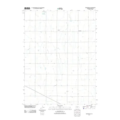
2011 Map of Bertrand SE
USGS Topo · Published 2011About this map
Sandstrom Cemetery stands as a quiet focal point in this agricultural landscape of Phelps County, situated amidst the strictly ordered section lines typical of the Nebraska prairie. The northern edge of this area is dominated by the waters of Johnson Reservoir, held by the massive Johnson Dam, which serves as a vital component of regional water management. This 2011 survey illustrates the precise grid of rural roads, such as 744 RD and D RD, that facilitate the intensive farming of the region. The settlement of Westmark appears near the eastern border, while the presence of Lateral E-65 highlights the sophisticated irrigation infrastructure required to sustain the local economy. The map provides a clear record of property boundaries and rural infrastructure at the start of the 2010s.
Find a feature on this map
19 named features on this map. Tap any name to fly to it.
Don’t see what you’re looking for? This feature index may not catch every label — zoom into the map to look around manually.
Map Details
Editions of this 2011 Bertrand SE Map
This is the sole edition of this map. No revisions or reprints were ever made.
Other maps of this area

1896 · Lexington
USGS Topo · 1:125,000

1896 · Holdrege
USGS Topo · 1:125,000

1896 · Kearney
USGS Topo · 1:125,000

1896 · Arapahoe
USGS Topo · 1:125,000

1898 · Arapahoe
USGS Topo · 1:125,000

1899 · Lexington
USGS Topo · 1:125,000

1955 · Grand Island
USGS Topo · 1:250,000

1957 · Grand Island
USGS Topo · 1:250,000

1958 · Grand Island
USGS Topo · 1:250,000

1961 · Elm Creek West
USGS Topo · 1:24,000