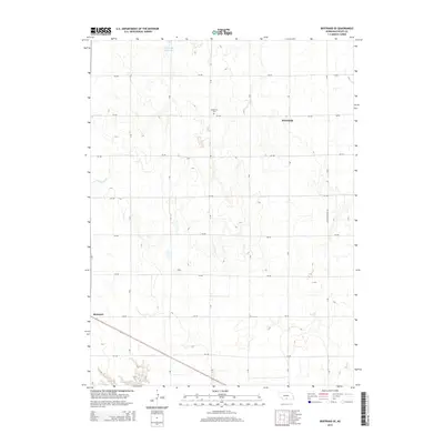
2014 Map of Bertrand SE
USGS Topo · Published 2014About this map
Bertrand anchors the southwestern corner of this Phelps County landscape, where the flat agricultural plains of Nebraska are defined by a rigid grid of rural roads and essential water infrastructure. The northern reaches are dominated by the Johnson Reservoir, a vital water resource for the region's farming economy. Evidence of early settlement and local genealogy is found at Sandstrom Cem, situated near the small community of Westmark. The map reveals a complex network of irrigation, most notably the Lateral E-65 canal, which cuts across the terrain to support the surrounding fields. Transportation follows a systematic pattern of lettered and numbered routes, including the primary north-south thoroughfare of Loomis-Overton Rd, illustrating the organized expansion of rural infrastructure into the 21st century.
Find a feature on this map
21 named features on this map. Tap any name to fly to it.
Don’t see what you’re looking for? This feature index may not catch every label — zoom into the map to look around manually.
Map Details
Editions of this 2014 Bertrand SE Map
This is the sole edition of this map. No revisions or reprints were ever made.
Other maps of this area

1896 · Lexington
USGS Topo · 1:125,000

1896 · Holdrege
USGS Topo · 1:125,000

1896 · Kearney
USGS Topo · 1:125,000

1896 · Arapahoe
USGS Topo · 1:125,000

1898 · Arapahoe
USGS Topo · 1:125,000

1899 · Lexington
USGS Topo · 1:125,000

1955 · Grand Island
USGS Topo · 1:250,000

1957 · Grand Island
USGS Topo · 1:250,000

1958 · Grand Island
USGS Topo · 1:250,000

1961 · Elm Creek West
USGS Topo · 1:24,000