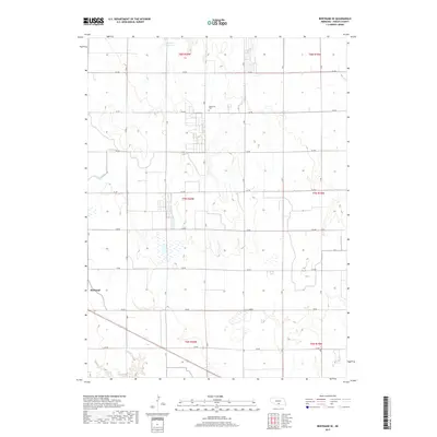
2017 Map of Bertrand SE
USGS Topo · Published 2017About this map
Johnson Reservoir defines the northern edge of this agricultural landscape in Phelps County, where the transition from surface water to an engineered irrigation network becomes apparent through features like Lateral E-65.7. The terrain is strictly organized by a cardinal grid of rural roads, including A Rd and 744 Rd, which facilitate the region's deep-rooted farming tradition. Centrally located within this grid, the Sandstrom Cem serves as a quiet marker of early family history and local settlement. On the western periphery, the outskirts of Bertrand touch the map, showing how the village is integrated into the broader rural Township and Range system. This 2017 edition reflects the modern intersection of large-scale water management and the traditional Nebraska plains grid.
Find a feature on this map
25 named features on this map. Tap any name to fly to it.
Don’t see what you’re looking for? This feature index may not catch every label — zoom into the map to look around manually.
Map Details
Editions of this 2017 Bertrand SE Map
This is the sole edition of this map. No revisions or reprints were ever made.
Other maps of this area

1896 · Lexington
USGS Topo · 1:125,000

1896 · Holdrege
USGS Topo · 1:125,000

1896 · Kearney
USGS Topo · 1:125,000

1896 · Arapahoe
USGS Topo · 1:125,000

1898 · Arapahoe
USGS Topo · 1:125,000

1899 · Lexington
USGS Topo · 1:125,000

1955 · Grand Island
USGS Topo · 1:250,000

1957 · Grand Island
USGS Topo · 1:250,000

1958 · Grand Island
USGS Topo · 1:250,000

1961 · Elm Creek West
USGS Topo · 1:24,000