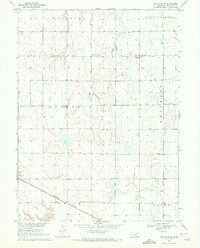
1970 Map of Bertrand SE
USGS Topo · Published 1972About this map
Agricultural development across the Phelps County plains is clearly defined by the township and range grid, organizing the landscape into the townships of West Blue, Williamsburg, and Garfield. In the early 1970s, this area south of the Platte River was characterized by an extensive network of irrigation infrastructure, indicated by the numerous wells dotting nearly every section of land. The village of Bertrand anchors the southwestern corner of the sheet, where a local Radio Tower and the Burlington Northern railroad line mark the settlement's role as a regional transport and communication hub.
Find a feature on this map
12 named features on this map. Tap any name to fly to it.
Don’t see what you’re looking for? This feature index may not catch every label — zoom into the map to look around manually.
Map Details
Editions of this 1970 Bertrand SE Map
This is the sole edition of this map. No revisions or reprints were ever made.
Other maps of this area

1896 · Lexington
USGS Topo · 1:125,000

1896 · Holdrege
USGS Topo · 1:125,000

1896 · Kearney
USGS Topo · 1:125,000

1896 · Arapahoe
USGS Topo · 1:125,000

1898 · Arapahoe
USGS Topo · 1:125,000

1899 · Lexington
USGS Topo · 1:125,000

1955 · Grand Island
USGS Topo · 1:250,000

1957 · Grand Island
USGS Topo · 1:250,000

1958 · Grand Island
USGS Topo · 1:250,000

1961 · Elm Creek West
USGS Topo · 1:24,000