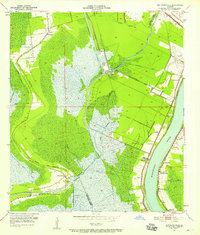
1951 Map of Bertrandville
USGS Topo · Published 1958About this map
The Mississippi River and its accompanying industrial and agricultural landscape dominate the eastern edge of this 1950s survey, while the vast wetlands of the West Bank define the interior. The contrast between the riverine corridor and the deep marsh is sharp, marked by a series of named plantations and settlements like Bertrandville, Promised Land, and Oakville clustered along the levee. This period reveals a landscape transitioning through mid-century infrastructure projects, including the Intracoastal Waterway and the expansion of drainage features such as the Concession Canal. Inland, the map captures the community of Crown Point near the junction of Bayou des Familles and Bayou Barataria. These waterways, coupled with the Southern Pacific and Missouri Pacific railroads, highlight the vital transport networks that supported the region's river-and-bayou economy before modern highway dominance. Local institutions including St Johns Ch and the Woodlawn Sch provide essential touchpoints for genealogical research.
Find a feature on this map
37 named features on this map. Tap any name to fly to it.
Don’t see what you’re looking for? This feature index may not catch every label — zoom into the map to look around manually.
Map Details
Editions of this 1951 Bertrandville Map
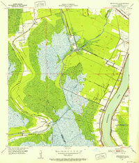
2 editions found
Other maps of this area

1891 · Pointe a La Hache
USGS Topo · 1:62,500

1891 · New Orleans
USGS Topo · 1:62,500

1892 · Barataria
USGS Topo · 1:62,500

1892 · St. Bernard
USGS Topo · 1:62,500

1892 · Pointe a La Hache
USGS Topo · 1:62,500

1932 · New Orleans NE
USGS Topo · 1:31,680

1932 · New Orleans NW
USGS Topo · 1:31,680

1932 · New Orleans SE
USGS Topo · 1:31,680

1932 · New Orleans SW
USGS Topo · 1:31,680
1938 · New Orleans West
USGS Topo · 1:31,680