
1954 Map of Berwick
USGS Topo · Published 1956About this map
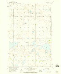
The Great Northern railroad cuts through the northern edge of this prairie landscape, anchoring the settlement of Berwick. This mid-century survey captures a rural landscape transitioning between the townships of Gorman, Jefferson, and Berwick. The distribution of educational and religious institutions, such as Zion Ch and the distinctively named German Sch No 4 and German Sch No 2, suggests a community rooted in specific cultural and linguistic heritage. To the north, the waters of Rush Lake and the marshy terrain of Ness interrupt the grid of section lines, while several Gravel Pits indicate local extractive industry supporting the area's infrastructure. The numerous numbered schoolhouses, from School No 1 through School No 4, illustrate the dense network of one-room districts that once served this portion of Pierce and McHenry Counties.
Find a feature on this map
17 named features on this map. Tap any name to fly to it.
Don’t see what you’re looking for? This feature index may not catch every label — zoom into the map to look around manually.
Map Details
Editions of this 1954 Berwick Map
This is the sole edition of this map. No revisions or reprints were ever made.
Other maps of this area

1954 · Tunbridge
USGS Topo · 1:24,000

1954 · Towner NE
USGS Topo · 1:24,000

1954 · Round Lake
USGS Topo · 1:24,000

1954 · Leverich
USGS Topo · 1:24,000

1954 · Towner SE
USGS Topo · 1:24,000

1954 · Minot
USGS Topo · 1:250,000

1955 · Rangeley NE
USGS Topo · 1:24,000

1958 · Minot
USGS Topo · 1:250,000
1958 · Balta NW
USGS Topo · 1:24,000

1958 · Balta
USGS Topo · 1:24,000