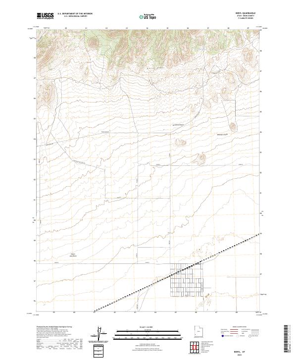
2023 Map of Beryl
USGS Topo · Published 2023About this map
The Escalante Desert floor dominates the southern half of this landscape, where the settlement of Beryl is situated at the intersection of a grid-based road network including N Beryl Hwy and several numbered thoroughfares like 10400 N. This high-desert environment transitions abruptly to the north into the elevated terrain of the North Peaks and S Fork East Peaks. Water sources are sparse but critical markers in this arid region, noted by Culver Spring and the drainage of Negro Liza Wash. The map reveals a land defined by modern infrastructure—such as the Liza East-Pipe Line Rd—superimposed over traditional landmarks like Websters Knolls and Bible Springs. It illustrates the typical Great Basin pattern of wide, flat basins used for limited agriculture and transportation, hemmed in by steep, isolated mountain ranges.
Find a feature on this map
15 named features on this map. Tap any name to fly to it.
Don’t see what you’re looking for? This feature index may not catch every label — zoom into the map to look around manually.
Map Details
Editions of this 2023 Beryl Map
This is the sole edition of this map. No revisions or reprints were ever made.
Other maps of this area

1885 · St. George
USGS Topo · 1:250,000

1891 · St. George
USGS Topo · 1:250,000

1953 · Richfield
USGS Topo · 1:250,000

1953 · Cedar City
USGS Topo · 1:250,000

1958 · Richfield
USGS Topo · 1:250,000

1958 · Cedar City
USGS Topo · 1:250,000

1962 · Cedar City
USGS Topo · 1:250,000

1971 · Bible Spring
USGS Topo · 1:24,000

1971 · Steamboat Mtn
USGS Topo · 1:24,000
1972 · Mountain Spring Peak
USGS Topo · 1:24,000