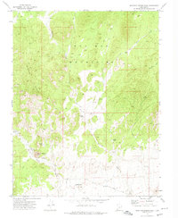
1972 Map of Mountain Spring Peak
USGS Topo · Published 1974About this map
The Wah Wah Mountains dominate this arid landscape in Iron County, where water sources dictate the geography of human activity. Essential water points such as Mountain Spring, Fourmile Spring, and the curiously named Pollywog Spring are connected by a network of primitive routes, including Jeep Trails and unnamed footpaths. In the southwest, Mountain Spring Peak rises above the Pine Valley floor, which is skirted by the Pine Valley Road.
Find a feature on this map
30 named features on this map. Tap any name to fly to it.
Don’t see what you’re looking for? This feature index may not catch every label — zoom into the map to look around manually.
Map Details
Editions of this 1972 Mountain Spring Peak Map
2 editions found

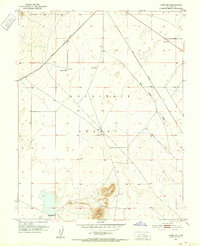
Other maps of this area

1885 · St. George
USGS Topo · 1:250,000

1891 · St. George
USGS Topo · 1:250,000
1951 · Avon NW
USGS Topo · 1:24,000

1953 · Richfield
USGS Topo · 1:250,000

1953 · Cedar City
USGS Topo · 1:250,000

1958 · Richfield
USGS Topo · 1:250,000

1958 · Cedar City
USGS Topo · 1:250,000

1962 · Cedar City
USGS Topo · 1:250,000
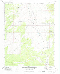
1971 · Observation Knoll
USGS Topo · 1:24,000

1971 · Lund
USGS Topo · 1:24,000