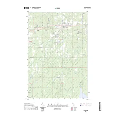
2023 Map of Bessemer
USGS Topo · Published 2023About this map
The Gogebic Range forms the geological spine of this landscape, where mining-era settlements follow the iron-rich geology along a narrow corridor of residential streets. Bessemer serves as the focal point, anchored by the Gogebic County Courthouse and flanked by the smaller company-town footprints of Yale, Anvil, and Ramsay. This modern survey illustrates the transition of the former rail corridors into the Ironwood to Bessemer State Trl, which now connects these communities across a landscape defined by industrial history and natural recovery. North of the town centers, the terrain rises toward the Hillcrest Cem, while to the south, the map reveals a vast forest network drained by the Black River and McDonald Creek. Notable natural features like Granite Falls and McDonald Lake emphasize the wilder character of the land beyond the historical mining hubs.
Find a feature on this map
67 named features on this map. Tap any name to fly to it.
Don’t see what you’re looking for? This feature index may not catch every label — zoom into the map to look around manually.
Map Details
Editions of this 2023 Bessemer Map
This is the sole edition of this map. No revisions or reprints were ever made.
Other maps of this area

1943 · Ironwood
USGS Topo · 1:48,000

1953 · Ashland
USGS Topo · 1:250,000

1955 · Ironwood
USGS Topo · 1:24,000

1955 · Bessemer
USGS Topo · 1:24,000

1955 · Wakefield
USGS Topo · 1:24,000

1955 · Wakefield
USGS Topo · 1:62,500

1955 · Ironwood
USGS Topo · 1:62,500

1956 · North Ironwood
USGS Topo · 1:62,500

1956 · Thomaston
USGS Topo · 1:62,500

1958 · Ashland
USGS Topo · 1:250,000