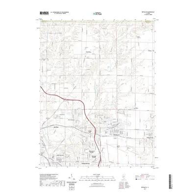
2021 Map of Bethalto
USGS Topo · Published 2021About this map
Bethalto and its surrounding suburban communities sit at a vital transportation and drainage junction in Madison County, defined by the winding paths of the West Fork Wood River and East Fork Wood River. The landscape reveals a transition from the established street grids of Alton and East Alton to the northern residential pockets of Fosterburg and Dorsey. The central portion of the map is dominated by the St Louis Regional Airport, which serves as a major industrial and logistical anchor for the region. Significant genealogical data is present through numerous memorial sites, including Rose Lawn Memory Gardens and the Pruett Family Cem. The northern terrain, including the Seven Hills area, shows more dissected topography compared to the flatter developments near Rosewood Heights and Oakwood Heights.
Find a feature on this map
84 named features on this map. Tap any name to fly to it.
Don’t see what you’re looking for? This feature index may not catch every label — zoom into the map to look around manually.
Map Details
Editions of this 2021 Bethalto Map
This is the sole edition of this map. No revisions or reprints were ever made.
Other maps of this area

1912 · Gillespie
USGS Topo · 1:62,500

1915 · Gillespie
USGS Topo · 1:62,500

1925 · Brighton
USGS Topo · 1:62,500

1927 · Alton
USGS Topo · 1:62,500

1927 · Edwardsville
USGS Topo · 1:62,500

1928 · Brighton
USGS Topo · 1:62,500

1932 · Edwardsville
USGS Topo · 1:62,500

1934 · Alton
USGS Topo · 1:62,500

1935 · Columbia Bottom
USGS Topo · 1:24,000

1948 · Quincy
USGS Topo · 1:250,000