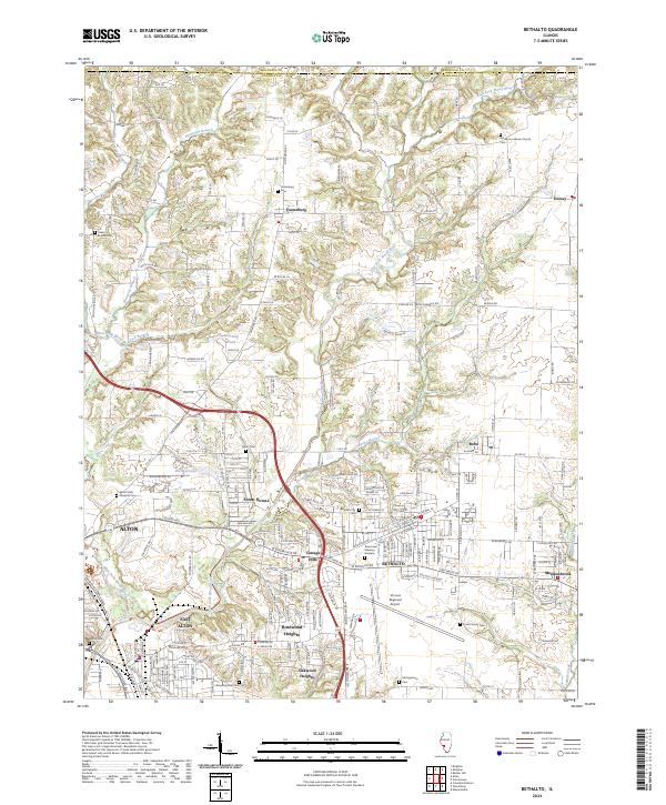
2024 Map of Bethalto
USGS Topo · Published 2024About this map
Bethalto and its surrounding communities in Madison County sit at a geographic crossroads north of the St. Louis metropolitan area. This landscape is defined by the winding course of the East Fork Wood River and its numerous tributaries, such as Honeycut Branch and Rocky Branch, which create a complex system of wooded draws and ridges between established residential hubs. The St Louis Regional Airport serves as a major regional landmark, situated just south of the main Bethalto settlement and north of Rosewood Heights.
Find a feature on this map
228 named features on this map. Tap any name to fly to it.
Don’t see what you’re looking for? This feature index may not catch every label — zoom into the map to look around manually.
Map Details
Editions of this 2024 Bethalto Map
This is the sole edition of this map. No revisions or reprints were ever made.
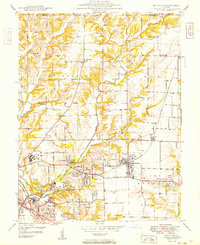
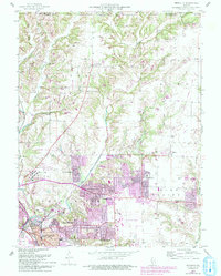
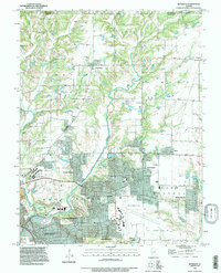
Historical Maps of East Alton Through Time
4 maps found