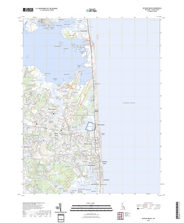
2023 Map of Bethany Beach
USGS Topo · Published 2023About this map
Bethany Beach and the neighboring coastal communities of the Delmarva Peninsula define this landscape, where the Atlantic shoreline meets a complex network of bays and inland waterways. The Assawoman Canal serves as a primary artery, cutting through the terrain to connect Indian River Bay with waters further south. To the west, the long-established inland towns of Millville and Ocean View provide a genealogical anchor for the region, housing several notable local landmarks such as the Mariners Bethel United Methodist Church and the Ocean View Presbyterian Cemetery.
Find a feature on this map
232 named features on this map. Tap any name to fly to it.
Don’t see what you’re looking for? This feature index may not catch every label — zoom into the map to look around manually.
Map Details
Editions of this 2023 Bethany Beach Map
This is the sole edition of this map. No revisions or reprints were ever made.
Other maps of this area

1901 · Ocean City
USGS Topo · 1:62,500

1918 · Rehoboth
USGS Topo · 1:62,500

1938 · Rehoboth
USGS Topo · 1:62,500

1942 · Ocean City
USGS Topo · 1:62,500

1943 · Selbyville
USGS Topo · 1:31,680
1943 · Assawoman Bay
USGS Topo · 1:31,680

1943 · Fairmount
USGS Topo · 1:24,000
1943 · Bethany Beach
USGS Topo · 1:24,000
1944 · Rehoboth
USGS Topo · 1:62,500

1946 · Salisbury
USGS Topo · 1:250,000