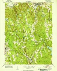
1951 Map of Bethel
USGS Topo · Published 1953About this map
Putnam Memorial Camp Grounds and the surrounding woodlands of Wooster Mountain State Park define the mid-century landscape of this corner of Fairfield County. This survey captures the transition from rural agricultural roots to post-war residential growth, centered on the New York New Haven and Hartford railroad line which links the settlements of Branchville, Georgetown, and West Redding. The hydrography is dominated by the Saugatuck Reservoir to the southeast and numerous smaller bodies like Eureka Lake and Waubeeka Lake, many of which supported local industry or recreation. Local life is documented through established institutions such as Wooster Sch and Grassy Plain Sch, while the presence of Danbury Airport in the north indicates the era's advancing transportation infrastructure. The map preserves the names of early family landholdings and small rural communities like Florida Hill and Boston, providing a detailed record of the region before more intensive suburban development.
Find a feature on this map
90 named features on this map. Tap any name to fly to it.
Don’t see what you’re looking for? This feature index may not catch every label — zoom into the map to look around manually.
Map Details
Editions of this 1951 Bethel Map
2 editions found
Other maps of this area

1892 · Stamford
USGS Topo · 1:62,500

1892 · Danbury
USGS Topo · 1:62,500

1892 · Norwalk
USGS Topo · 1:62,500

1892 · Carmel
USGS Topo · 1:62,500

1893 · Carmel
USGS Topo · 1:62,500

1893 · Stamford
USGS Topo · 1:62,500

1893 · Norwalk
USGS Topo · 1:62,500

1894 · Carmel
USGS Topo · 1:62,500

1899 · Stamford
USGS Topo · 1:62,500

1915 · Danbury
USGS Topo · 1:62,500