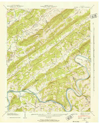
1941 Map of Bethel Valley
USGS Topo · Published 1952About this map
Parallel ridges and deep valleys define this section of the Tennessee Valley, where the Clinch River carves a winding path through Bethel Valley and Gallaher Bend. The landscape is organized by these natural formations, with Blackoak Ridge, Pine Ridge, and Chestnut Ridge creating distinct corridors for early 20th-century life. Evidence of established rural communities is widespread, marked by a high density of country churches and family burial grounds such as the Hembree Cem, Currier Cem, and Douglas Chapel & Cem.
Find a feature on this map
70 named features on this map. Tap any name to fly to it.
Don’t see what you’re looking for? This feature index may not catch every label — zoom into the map to look around manually.
Map Details
Editions of this 1941 Bethel Valley Map
3 editions found
Other maps of this area

1893 · Briceville
USGS Topo · 1:125,000

1895 · Loudon
USGS Topo · 1:125,000

1895 · Briceville
USGS Topo · 1:125,000

1896 · Briceville
USGS Topo · 1:125,000

1935 · Lenoir City
USGS Topo · 1:24,000

1935 · Elverton
USGS Topo · 1:24,000

1935 · Bethel Valley
USGS Topo · 1:24,000

1935 · Lovell
USGS Topo · 1:24,000

1936 · Cave Creek
USGS Topo · 1:24,000

1936 · Windrock
USGS Topo · 1:24,000