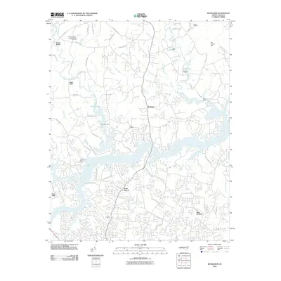
2010 Map of Bethlehem
USGS Topo · Published 2010About this map
The Upper Little River and its numerous branches, including Rock Creek and Isaac Creek, define the landscape of Alexander and Catawba counties at the start of the 21st century. This area north of the Catawba River valley shows significant residential development and water management, highlighted by the intricate fingers of Rink Lake and the Rink Reservoir. Historically significant family and community landmarks are scattered throughout the region, such as Bentley Cemetery, Pisgah Cemetery, and Rocky Mount Cemetery.
Find a feature on this map
72 named features on this map. Tap any name to fly to it.
Don’t see what you’re looking for? This feature index may not catch every label — zoom into the map to look around manually.
Map Details
Editions of this 2010 Bethlehem Map
This is the sole edition of this map. No revisions or reprints were ever made.
Other maps of this area

1895 · Hickory
USGS Topo · 1:125,000

1953 · Charlotte
USGS Topo · 1:250,000

1954 · Charlotte
USGS Topo · 1:250,000

1960 · Charlotte
USGS Topo · 1:250,000

1962 · Charlotte
USGS Topo · 1:250,000

1970 · Bethlehem
USGS Topo · 1:24,000

1970 · Newton
USGS Topo · 1:24,000
1970 · Granite Falls
USGS Topo · 1:24,000
1970 · Ellendale
USGS Topo · 1:24,000
1970 · Longview
USGS Topo · 1:24,000