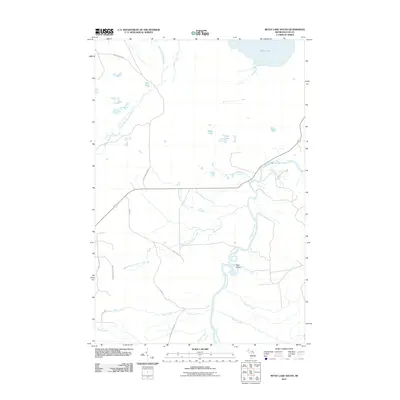
2011 Map of Betsy Lake South
USGS Topo · Published 2011About this map
The Tahquamenon River winds through this section of Luce County, featuring the prominent Upper Falls in the northeast and encircling Joys Island further downstream. This landscape is defined by its complex network of waterways and glacial lakes, including Betsy Lake and the smaller Rat Lake to the west. The area's drainage is further complicated by the Little Two Hearted River and several branches of Linton Creek, which intersect the territory between sparse logging roads.
Find a feature on this map
27 named features on this map. Tap any name to fly to it.
Don’t see what you’re looking for? This feature index may not catch every label — zoom into the map to look around manually.
Map Details
Editions of this 2011 Betsy Lake South Map
This is the sole edition of this map. No revisions or reprints were ever made.
Other maps of this area

1951 · Sheephead Lake
USGS Topo · 1:24,000

1951 · Big Beaver Creek
USGS Topo · 1:24,000

1951 · Timberlost
USGS Topo · 1:24,000

1951 · Eckerman
USGS Topo · 1:62,500

1951 · Shelldrake
USGS Topo · 1:62,500

1954 · Sault Sainte Marie
USGS Topo · 1:250,000

1956 · Sault Sainte Marie
USGS Topo · 1:250,000

1957 · Sault Sainte Marie
USGS Topo · 1:250,000

1958 · Sault Sainte Marie
USGS Topo · 1:250,000
1968 · Betsy Lake North
USGS Topo · 1:24,000