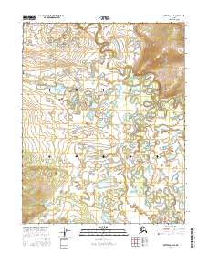
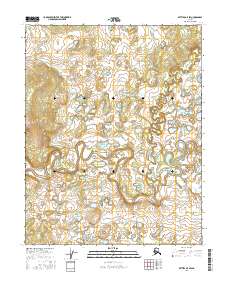
2016 Map of Bettles A-5 NE
USGS Topo · Published 2016About this map
Kanuti Flats dominates this portion of the Alaskan interior, revealing a complex aquatic landscape where the Kanuti River and Kanuti Kilolitna River wind through a dense network of oxbows and marshlands. This 2016 survey illustrates a classic permafrost-driven drainage pattern, where water bodies constantly shift across a low-lying basin. The confluence of these major waterways with smaller tributaries like Nolitna Cr and Kodosin Nolitna Cr creates a labyrinthine system of sloughs and ponds typical of the Yukon-Koyukuk region. Without roads or permanent structures shown on this sheet, the map serves as a primary record of the hydrography and natural boundaries within the Arctic Circle. This document is essential for understanding the seasonal water movements and untouched wilderness character of the region as it existed in the early twenty-first century.
Find a feature on this map
9 named features on this map. Tap any name to fly to it.
Don’t see what you’re looking for? This feature index may not catch every label — zoom into the map to look around manually.
Map Details
Editions of this 2016 Bettles A-5 NE Map
This is the sole edition of this map. No revisions or reprints were ever made.
Other maps of this area

1951 · Bettles
USGS Topo · 1:250,000

1956 · Bettles
USGS Topo · 1:250,000
1970 · Bettles B-4
USGS Topo · 1:63,360
1970 · Bettles A-4
USGS Topo · 1:63,360
1970 · Bettles B-5
USGS Topo · 1:63,360
1970 · Bettles A-5
USGS Topo · 1:63,360
2016 · Bettles B-4 SW
USGS Topo · 1:25,000
2016 · Bettles A-4 NW
USGS Topo · 1:25,000
2016 · Bettles B-5 SE
USGS Topo · 1:25,000
2016 · Bettles B-5 SW
USGS Topo · 1:25,000