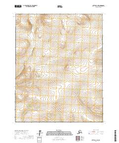
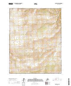
2017 Map of Bettles B-1 NE
USGS Topo · Published 2017About this map
The Kanuti River and the headwaters of the Hodzana River define the hydrography of this interior Alaska wilderness. Located within the Yukon-Koyukuk region, the landscape is characterized by a dense network of wetlands and seasonal watercourses typical of the subarctic tundra. The terrain is marked by significant topographic variation, ranging from low-lying marshlands to rolling interior uplands. Surveyed for the Public Land Survey System, the area is partitioned into townships including t19n r13w, t19n r12w, t18n r13w, and t18n r12w. This 2017 edition provides a precise look at the drainage patterns before they reach the larger arterial rivers of the Yukon basin, offering a baseline for environmental researchers and those studying the remote hydrology of the Alaskan interior.
Find a feature on this map
6 named features on this map. Tap any name to fly to it.
Don’t see what you’re looking for? This feature index may not catch every label — zoom into the map to look around manually.
Map Details
Editions of this 2017 Bettles B-1 NE Map
This is the sole edition of this map. No revisions or reprints were ever made.
Other maps of this area

1951 · Bettles
USGS Topo · 1:250,000

1951 · Beaver
USGS Topo · 1:250,000

1956 · Bettles
USGS Topo · 1:250,000

1956 · Beaver
USGS Topo · 1:250,000

1964 · Beaver
USGS Topo · 1:250,000
1970 · Beaver C-6
USGS Topo · 1:63,360

1970 · Beaver B-6
USGS Topo · 1:63,360
1970 · Bettles C-1
USGS Topo · 1:63,360
1970 · Bettles B-1
USGS Topo · 1:63,360
2017 · Beaver C-6 SW
USGS Topo · 1:25,000