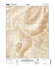
2016 Map of Bettles B-3 SW
USGS Topo · Published 2016About this map
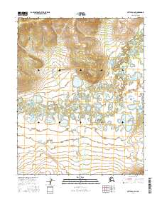
The Alaskan wilderness within the Yukon-Koyukuk region is defined by its topographic complexity in this 2016 survey. This specific quadrangle reflects the transition across the public land survey system lines of T18n R18w, T18n R17w, T17n R18w, and T17n R17w. The terrain is characterized by significant elevation changes, with numerous peaks and ridge lines rising above the surrounding lowlands. The drainage patterns and small wetlands visible in the lower-lying corners indicate the natural water movement through this remote landscape, which remained largely unsettled at the time of this mapping. The lack of man-made structures or established roads highlights the pristine nature of the interior during the early 21st century.
Find a feature on this map
4 named features on this map. Tap any name to fly to it.
Don’t see what you’re looking for? This feature index may not catch every label — zoom into the map to look around manually.
Map Details
Editions of this 2016 Bettles B-3 SW Map
This is the sole edition of this map. No revisions or reprints were ever made.
Other maps of this area

1951 · Bettles
USGS Topo · 1:250,000

1956 · Bettles
USGS Topo · 1:250,000
1970 · Bettles B-4
USGS Topo · 1:63,360
1970 · Bettles A-3
USGS Topo · 1:63,360
1970 · Bettles A-4
USGS Topo · 1:63,360
1970 · Bettles B-3
USGS Topo · 1:63,360
2016 · Bettles B-4 SE
USGS Topo · 1:25,000
2016 · Bettles B-4 NE
USGS Topo · 1:25,000
2016 · Bettles A-3 NW
USGS Topo · 1:25,000
2016 · Bettles A-4 NE
USGS Topo · 1:25,000