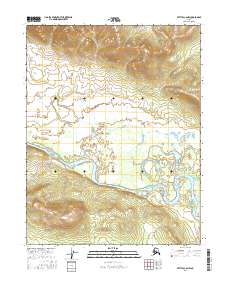
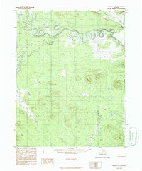
2016 Map of Bettles C-6 NW
USGS Topo · Published 2016About this map
The Alatna River dominates this landscape, its winding course and shifting sandbars carving through the interior wilderness within the t21n r25w and t21n r24w township boundaries. This remote portion of the Alaskan interior is defined by significant elevation changes, ranging from the low-lying river basin to the high mountain peaks and ridgelines in the north. The survey illustrates the characteristic braided nature of Arctic waterways, where the river's path is marked by numerous islands and intricate sloughs. This terrain remains largely undeveloped, showcasing the natural topography of the Brooks Range foothills before any modern infrastructure or settlement reached this corner of the Yukon-Koyukuk region.
Find a feature on this map
5 named features on this map. Tap any name to fly to it.
Don’t see what you’re looking for? This feature index may not catch every label — zoom into the map to look around manually.
Map Details
Editions of this 2016 Bettles C-6 NW Map
This is the sole edition of this map. No revisions or reprints were ever made.
Other maps of this area

1951 · Hughes
USGS Topo · 1:250,000

1951 · Bettles
USGS Topo · 1:250,000

1956 · Hughes
USGS Topo · 1:250,000

1956 · Bettles
USGS Topo · 1:250,000

1964 · Hughes
USGS Topo · 1:250,000

1965 · Hughes
USGS Topo · 1:250,000
1970 · Bettles D-6
USGS Topo · 1:63,360
1970 · Bettles C-6
USGS Topo · 1:63,360
1986 · Hughes D-1
USGS Topo · 1:63,360
1986 · Hughes C-1
USGS Topo · 1:63,360