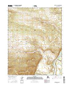
2016 Map of Bettles C-6 SW
USGS Topo · Published 2016About this map
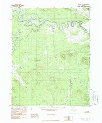
Alatna sits as a primary point of settlement along the western edge of the wide Koyukuk River valley in this 2016 survey. The terrain is defined by the sharp transition from the river's floodplains to the rising uplands of the t20n r25w and t21n r25w townships. These interior lands are carved by drainage systems like Bergman Cr, which snakes through the hills before descending toward the river basin. In the southeastern corner of the quadrangle, the Tasiswane Lake lies near the river's path, indicating the wetland-rich character of the low-lying Koyukuk valley. The map documents the relationship between the small inland village and the expansive, remote hydrological network of the Alaskan interior during the early 21st century.
Find a feature on this map
10 named features on this map. Tap any name to fly to it.
Don’t see what you’re looking for? This feature index may not catch every label — zoom into the map to look around manually.
Map Details
Editions of this 2016 Bettles C-6 SW Map
This is the sole edition of this map. No revisions or reprints were ever made.
Other maps of this area

1951 · Hughes
USGS Topo · 1:250,000

1951 · Bettles
USGS Topo · 1:250,000

1956 · Hughes
USGS Topo · 1:250,000

1956 · Bettles
USGS Topo · 1:250,000

1964 · Hughes
USGS Topo · 1:250,000

1965 · Hughes
USGS Topo · 1:250,000
1970 · Bettles B-6
USGS Topo · 1:63,360
1970 · Bettles C-6
USGS Topo · 1:63,360
1986 · Hughes B-1
USGS Topo · 1:63,360
1986 · Hughes C-1
USGS Topo · 1:63,360