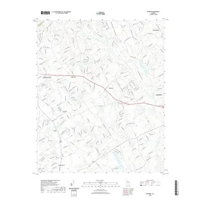
2020 Map of Between
USGS Topo · Published 2020About this map
Walnut Grove and the crossroads of Between anchor this landscape where residential growth meets the agricultural heritage of Walton County. The terrain is defined by the winding course of the Alcovy River and its numerous tributaries, including Big Flat Cr and Little Flat Cr, which have historically shaped the settlement patterns of the region. Local genealogy is well-represented through numerous family-named burial grounds such as Tucker Cem, Jones Cem, and Brooks Cem, alongside the more modern Corinth Memorial Gardens. Small-scale aviation is present at Spring Valley Farm Airport, reflecting the area's mix of rural and suburban utility. The map traces the transition from larger land tracts to subdivided residential lanes, preserving the names of old communities like Split Silk and Youth even as the surrounding area modernizes towards the county seat at Monroe.
Find a feature on this map
224 named features on this map. Tap any name to fly to it.
Don’t see what you’re looking for? This feature index may not catch every label — zoom into the map to look around manually.
Map Details
Editions of this 2020 Between Map
This is the sole edition of this map. No revisions or reprints were ever made.
Other maps of this area

1896 · Monroe
USGS Topo · 1:125,000

1953 · Athens
USGS Topo · 1:250,000

1958 · Athens
USGS Topo · 1:250,000

1959 · Athens
USGS Topo · 1:250,000

1963 · Athens
USGS Topo · 1:250,000

1964 · Bold Springs
USGS Topo · 1:24,000
1964 · Loganville
USGS Topo · 1:24,000

1964 · Between
USGS Topo · 1:24,000

1964 · Monroe
USGS Topo · 1:24,000

1964 · Winder South
USGS Topo · 1:24,000