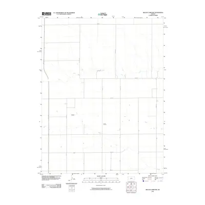
2010 Map of Beulah Cemetery
USGS Topo · Published 2010About this map
Beulah Cemetery sits at the heart of this Western Kansas landscape, marking a quiet point of remembrance amidst the vast agricultural sections of Wichita County. The terrain is defined by the winding course of Chalk Creek, which meanders east-west across the northern and central portions of the quadrangle. Transport and infrastructure are characterized by a precise grid of rural roads, including Adobe Rd and State Hwy 25, which provide the primary north-south artery for the region. A notable specialized landmark is Hobson Airport, located west of the cemetery, serving the aerial needs of this farming community. This 2010 survey reflects the enduring rural character of the High Plains, where human settlement is sparse and centered around established landmarks and essential watercourses like the creek that cuts through the Dakota boundary area.
Find a feature on this map
17 named features on this map. Tap any name to fly to it.
Don’t see what you’re looking for? This feature index may not catch every label — zoom into the map to look around manually.
Map Details
Editions of this 2010 Beulah Cemetery Map
This is the sole edition of this map. No revisions or reprints were ever made.
Other maps of this area

1939 · Pence
USGS Topo · 1:62,500

1941 · Pence
USGS Topo · 1:62,500

1955 · Scott City
USGS Topo · 1:250,000

1958 · Scott City
USGS Topo · 1:250,000

1968 · Russell Springs 3 SW
USGS Topo · 1:24,000

1968 · Russell Springs 3 NW
USGS Topo · 1:24,000

1968 · Russell Springs 3 SE
USGS Topo · 1:24,000

1968 · Russell Springs 3 NE
USGS Topo · 1:24,000

1969 · Russell Springs 2 SW
USGS Topo · 1:24,000

1969 · Russell Springs 2 SE
USGS Topo · 1:24,000