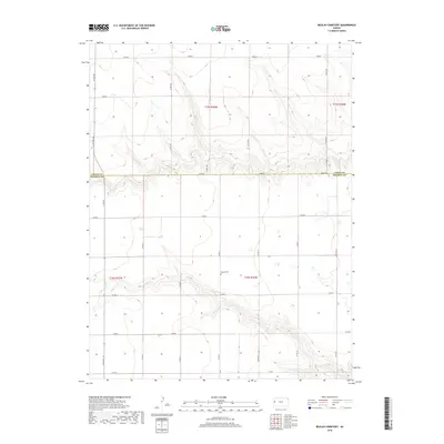
2018 Map of Beulah Cemetery
USGS Topo · Published 2018About this map
Beulah Cem sits at the heart of this high plains landscape, marking a solitary point of local history in a region defined by its rigid section lines and agricultural grids. The map covers the borderlands of the western Kansas panhandle, where Logan Co and Wichita Co meet along Adobe Rd. This 2018 survey illustrates the persistent geometry of the American West, where namesake points like Dakota and Coyote anchor a vast network of section roads including Co Rd 160 and Co Rd 220. The terrain is characterized by subtle drainage patterns and the organized expansion of township and range divisions, specifically t15s r36w and t16s r36w. For those tracing local roots, the map provides a precise layout of the rural road system that connects these isolated western homesteads.
Find a feature on this map
24 named features on this map. Tap any name to fly to it.
Don’t see what you’re looking for? This feature index may not catch every label — zoom into the map to look around manually.
Map Details
Editions of this 2018 Beulah Cemetery Map
This is the sole edition of this map. No revisions or reprints were ever made.
Other maps of this area

1939 · Pence
USGS Topo · 1:62,500

1941 · Pence
USGS Topo · 1:62,500

1955 · Scott City
USGS Topo · 1:250,000

1958 · Scott City
USGS Topo · 1:250,000

1968 · Russell Springs 3 SW
USGS Topo · 1:24,000

1968 · Russell Springs 3 NW
USGS Topo · 1:24,000

1968 · Russell Springs 3 SE
USGS Topo · 1:24,000

1968 · Russell Springs 3 NE
USGS Topo · 1:24,000

1969 · Russell Springs 2 SW
USGS Topo · 1:24,000

1969 · Russell Springs 2 SE
USGS Topo · 1:24,000