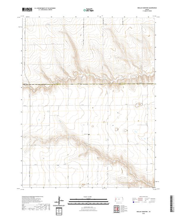
2022 Map of Beulah Cemetery
USGS Topo · Published 2022About this map
Beulah Cem serves as a quiet landmark on this high plains landscape along the county line between Logan and Wichita Counties. In the early 21st century, the area remains defined by a strict section-line road grid, including Adobe Rd and Co Rd 160, which navigate the subtle drainage patterns of the Dakota region. This map illustrates the intersection of traditional land divisions and the natural topography of western Kansas, where intermittent watercourses and small depressions interrupt the otherwise geometric regularity of the rural landscape. For those researching local history or genealogy, the presence of isolated burial sites like Beulah Cem provides a vital point of reference for identifying the small communities that have sustained this agricultural region through generations.
Find a feature on this map
20 named features on this map. Tap any name to fly to it.
Don’t see what you’re looking for? This feature index may not catch every label — zoom into the map to look around manually.
Map Details
Editions of this 2022 Beulah Cemetery Map
This is the sole edition of this map. No revisions or reprints were ever made.
Other maps of this area

1939 · Pence
USGS Topo · 1:62,500

1941 · Pence
USGS Topo · 1:62,500

1955 · Scott City
USGS Topo · 1:250,000

1958 · Scott City
USGS Topo · 1:250,000

1968 · Russell Springs 3 SW
USGS Topo · 1:24,000

1968 · Russell Springs 3 NW
USGS Topo · 1:24,000

1968 · Russell Springs 3 SE
USGS Topo · 1:24,000

1968 · Russell Springs 3 NE
USGS Topo · 1:24,000

1969 · Russell Springs 2 SW
USGS Topo · 1:24,000

1969 · Russell Springs 2 SE
USGS Topo · 1:24,000