1963 Map of Beulah NE
USGS Topo · Published 1965About this map
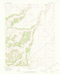
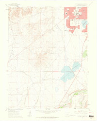
Minnequa Canal cuts across the northern landscape of this Pueblo County region, representing the critical role of water management in the semi-arid Colorado environment during the early 1960s. The terrain transitions from the elevated expanse of Boggs Flat in the east to a series of deeply carved drainage systems. These waterways, including Peck Creek, Rock Creek, and Boggs Creek, dictate the movement of local travel, as seen with Red Creek Road following the natural contours of the land. The presence of several Well labels and smaller tributaries like Soda Creek and Galbeth Creek indicates a landscape primarily utilized for ranching and resource management. This topographic study, field-checked in 1963, provides a detailed look at the rural infrastructure and natural drainage patterns before modern development altered the local water table or expanded the road network beyond these primary routes.
Find a feature on this map
12 named features on this map. Tap any name to fly to it.
Don’t see what you’re looking for? This feature index may not catch every label — zoom into the map to look around manually.
Map Details
Editions of this 1963 Beulah NE Map
Other maps of this area

1891 · Pueblo
USGS Topo · 1:125,000

1894 · Pueblo
USGS Topo · 1:125,000

1896 · Pueblo
USGS Topo · 1:125,000

1897 · Pueblo
USGS Topo · 1:125,000

1954 · Pueblo
USGS Topo · 1:250,000

1957 · Pueblo
USGS Topo · 1:250,000

1958 · Pueblo
USGS Topo · 1:250,000
1961 · Northwest Pueblo
USGS Topo · 1:24,000
1961 · Southwest Pueblo
USGS Topo · 1:24,000

1962 · Pueblo
USGS Topo · 1:250,000