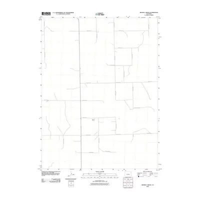
2010 Map of Beverly Grove
USGS Topo · Published 2010About this map
Beverly Grove is a quiet rural center in the high plains of northeastern Colorado, characterized by a structured grid of transport corridors. This 2010 survey illustrates the organized expansion of the agricultural landscape, where the terrain is neatly divided by an extensive network of thoroughfares including County Road 29, County Road D, and County Road H. These roads dictate the flow of movement through the region, connecting isolated farmsteads and agricultural operations to the larger county infrastructure. The map reveals the stark, rectilinear nature of the Yuma County prairie, showing how modern land management and road engineering have partitioned the open country into distinct parcels. Notable north-south arteries like County Road G and east-west routes such as County Road 24 provide clear evidence of the region's 21st-century settlement patterns and resource distribution.
Find a feature on this map
18 named features on this map. Tap any name to fly to it.
Don’t see what you’re looking for? This feature index may not catch every label — zoom into the map to look around manually.
Map Details
Editions of this 2010 Beverly Grove Map
This is the sole edition of this map. No revisions or reprints were ever made.
Other maps of this area

1954 · Limon
USGS Topo · 1:250,000

1954 · Sterling
USGS Topo · 1:250,000

1957 · Limon
USGS Topo · 1:250,000

1958 · Limon
USGS Topo · 1:250,000

1958 · Sterling
USGS Topo · 1:250,000

1968 · Abarr SE
USGS Topo · 1:24,000

1969 · Heartstrong
USGS Topo · 1:24,000

1969 · Schramm
USGS Topo · 1:24,000

1972 · Otis SE
USGS Topo · 1:24,000

1972 · Yuma South
USGS Topo · 1:24,000