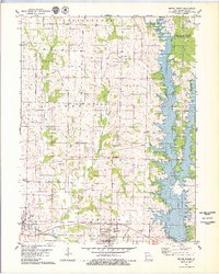
1979 Map of Bevier North
USGS Topo · Published 1979About this map
The construction of Long Branch Dam and the filling of Long Branch Lake define the landscape of central Macon County during this period. This transformation of the Long Branch valley represents a major shift in local geography, creating a large reservoir that neighbors the Atlanta State Wildlife Area. To the west, the historical settlements of Bevier and Callao maintain their presence along the Burlington Northern tracks, while the legacy of earlier transportation is visible in the Old Railroad Grade north of Bevier.
Find a feature on this map
35 named features on this map. Tap any name to fly to it.
Don’t see what you’re looking for? This feature index may not catch every label — zoom into the map to look around manually.
Map Details
Editions of this 1979 Bevier North Map
This is the sole edition of this map. No revisions or reprints were ever made.
Other maps of this area

1908 · Atlanta
USGS Topo · 1:62,500

1908 · Macon
USGS Topo · 1:62,500

1910 · Macon
USGS Topo · 1:62,500

1937 · Elmer
USGS Topo · 1:48,000

1942 · Elmer
USGS Topo · 1:62,500

1953 · Moberly
USGS Topo · 1:250,000

1953 · Bevier South
USGS Topo · 1:24,000

1953 · Lagonda
USGS Topo · 1:24,000

1954 · Moberly
USGS Topo · 1:250,000

1957 · Moberly
USGS Topo · 1:250,000