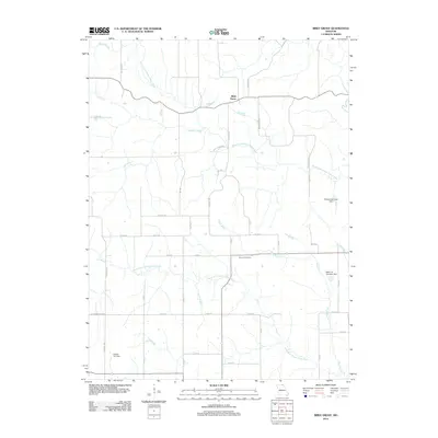
2012 Map of Bible Grove
USGS Topo · Published 2012About this map
The community of Bible Grove serves as the focal point of this northeast Missouri landscape, situated where the high ground meets the headwaters of the Fabius River system. The drainage pattern is a defining characteristic of the area, as the South Fork Middle Fabius River and North Fork South Fabius River carve numerous valleys across the township. These waterways are fed by smaller tributaries like Plum Branch, Meadow Brook, and Bee Branch, creating a repetitive sequence of ridges and creek bottoms that influenced the local road network.
Find a feature on this map
48 named features on this map. Tap any name to fly to it.
Don’t see what you’re looking for? This feature index may not catch every label — zoom into the map to look around manually.
Map Details
Editions of this 2012 Bible Grove Map
This is the sole edition of this map. No revisions or reprints were ever made.
Other maps of this area

1903 · Edina
USGS Topo · 1:125,000

1954 · Centerville
USGS Topo · 1:250,000

1957 · Centerville
USGS Topo · 1:250,000

1958 · Centerville
USGS Topo · 1:250,000

1965 · Memphis
USGS Topo · 1:24,000
1965 · Edina
USGS Topo · 1:24,000

1965 · Greensburg
USGS Topo · 1:24,000

1965 · Downing NW
USGS Topo · 1:24,000

1966 · Brashear
USGS Topo · 1:24,000

1966 · Downing
USGS Topo · 1:24,000