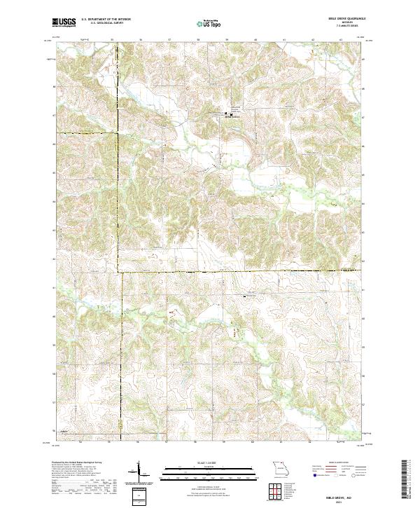
2021 Map of Bible Grove
USGS Topo · Published 2021About this map
S Fork Middle Fabius River and its numerous tributaries, including Bridge Cr and Bee Br, carve a complex drainage pattern across this northern Missouri landscape. The settlement of Bible Grove serves as a central landmark, notable for its dual ecclesiastical sites: the Bible Grove Christian Church Cem and the Bible Grove Church of Christ Cem. These sites, along with the Slocum Cem further south, provide significant points of interest for genealogical research in this rural borderland where Scotland, Schuyler, Adair, and Knox counties meet.
Find a feature on this map
59 named features on this map. Tap any name to fly to it.
Don’t see what you’re looking for? This feature index may not catch every label — zoom into the map to look around manually.
Map Details
Editions of this 2021 Bible Grove Map
This is the sole edition of this map. No revisions or reprints were ever made.
Other maps of this area

1903 · Edina
USGS Topo · 1:125,000

1954 · Centerville
USGS Topo · 1:250,000

1957 · Centerville
USGS Topo · 1:250,000

1958 · Centerville
USGS Topo · 1:250,000

1965 · Memphis
USGS Topo · 1:24,000
1965 · Edina
USGS Topo · 1:24,000

1965 · Greensburg
USGS Topo · 1:24,000

1965 · Downing NW
USGS Topo · 1:24,000

1966 · Brashear
USGS Topo · 1:24,000

1966 · Downing
USGS Topo · 1:24,000