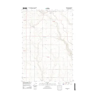
2013 Map of Bickleton
USGS Topo · Published 2013About this map
Bickleton and Cleveland anchor this high-plateau landscape in Klickitat County, where the transition from agricultural fields to the breaks of deep canyons is meticulously documented. The terrain is defined by the sharp descent into Big Horn Canyon and the winding course of Pine Cr, which drains the northern sections of the quadrangle. A network of rural arteries like Bickleton Timber Rd and Dot Rd connects these high-elevation homesteads and ranching tracts. To the south, the topography shifts toward Wood Gulch and the headwaters of White Cr. This 2013 survey provides a clear view of land-use patterns, showing the grid of section lines and the distribution of farmsteads along routes such as Van Nostern Rd and Gadeberg Rd, reflecting a region still primarily dedicated to dryland farming and timber management.
Find a feature on this map
27 named features on this map. Tap any name to fly to it.
Don’t see what you’re looking for? This feature index may not catch every label — zoom into the map to look around manually.
Map Details
Editions of this 2013 Bickleton Map
This is the sole edition of this map. No revisions or reprints were ever made.
Other maps of this area

1910 · Zillah
USGS Topo · 1:125,000

1916 · Arlington
USGS Topo · 1:125,000

1950 · Yakima
USGS Topo · 1:250,000

1953 · The Dalles
USGS Topo · 1:250,000

1956 · The Dalles
USGS Topo · 1:250,000

1957 · The Dalles
USGS Topo · 1:250,000

1958 · Yakima
USGS Topo · 1:250,000

1961 · Yakima
USGS Topo · 1:250,000
1962 · Crider Valley
USGS Topo · 1:24,000

1962 · Wood Gulch
USGS Topo · 1:24,000