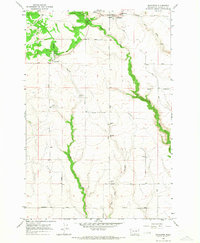
1965 Map of Bickleton
USGS Topo · Published 1967About this map
Bickleton and the nearby community of Cleveland anchor this mid-century survey of the high plateau in eastern Klickitat County. The landscape is defined by deep, winding drainages like Wood Gulch, Big Horn Canyon, and the riparian corridor of Pine Creek which cut through the agricultural tableland. This topography shaped a network of named section-line roads, such as Van Nostern Road and Duree Road, that connect isolated family farmsteads and rural landmarks.
Find a feature on this map
24 named features on this map. Tap any name to fly to it.
Don’t see what you’re looking for? This feature index may not catch every label — zoom into the map to look around manually.
Map Details
Editions of this 1965 Bickleton Map
This is the sole edition of this map. No revisions or reprints were ever made.
Other maps of this area

1910 · Zillah
USGS Topo · 1:125,000

1916 · Arlington
USGS Topo · 1:125,000

1950 · Yakima
USGS Topo · 1:250,000

1953 · The Dalles
USGS Topo · 1:250,000

1956 · The Dalles
USGS Topo · 1:250,000

1957 · The Dalles
USGS Topo · 1:250,000

1958 · Yakima
USGS Topo · 1:250,000

1961 · Yakima
USGS Topo · 1:250,000
1962 · Crider Valley
USGS Topo · 1:24,000

1962 · Wood Gulch
USGS Topo · 1:24,000