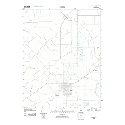
2010 Map of Bicknell
USGS Topo · Published 2010About this map
Bicknell serves as the primary urban center in this part of Knox County, characterized by a dense residential grid situated just north of Indian Creek. The surrounding landscape is a complex network of agricultural drainage, featuring numerous named waterways such as Tilley Ditch, Kuhn Ditch, and Pickle Ditch that feed into the larger river systems. To the west, the Barefoot Nation Hills provide a distinct topographical contrast to the flatter Mills Prairie found to the east near Edwardsport. The map reveals a high density of rural cemeteries, including Walker Cemetery, Chambers Cemetery, and the Odd Fellows Cemetery, which offer valuable points of reference for local genealogical research. In the southeast corner, the Fore and Atkinson Levee protects low-lying areas near the White River, illustrating the ongoing management of this riverine environment.
Find a feature on this map
73 named features on this map. Tap any name to fly to it.
Don’t see what you’re looking for? This feature index may not catch every label — zoom into the map to look around manually.
Map Details
Editions of this 2010 Bicknell Map
This is the sole edition of this map. No revisions or reprints were ever made.
Other maps of this area

1942 · Fritchton
USGS Topo · 1:24,000

1943 · Carlisle
USGS Topo · 1:24,000

1943 · Oaktown
USGS Topo · 1:24,000

1943 · Sandborn
USGS Topo · 1:24,000

1943 · Bicknell
USGS Topo · 1:24,000

1943 · Plainville
USGS Topo · 1:24,000

1944 · Bucktown
USGS Topo · 1:24,000

1944 · Fritchton
USGS Topo · 1:24,000

1944 · Washington
USGS Topo · 1:24,000

1944 · Wheatland
USGS Topo · 1:24,000