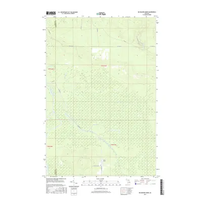
2017 Map of Big Beaver Creek
USGS Topo · Published 2017About this map
The East Branch Tahquamenon River winds through the lowlands of Chippewa County, defining a landscape dominated by extensive wetlands and seasonal waterways. This northern Michigan terrain is structured by a grid of rural roads such as W Maple Ridge Rd and N Hulbert Rd, which provide access to the remote interior sections of the Hiawatha National Forest region. Near the southern edge of the survey, Young's Airport serves as a lone aviation landmark amidst the dense network of creeks including Big Beaver Creek and the Hendrie River. The map also captures the boundary between Luce and Chippewa counties, where the Tahquamenon River system and Mackinaw Lake emphasize the importance of water drainage in this Upper Peninsula environment.
Find a feature on this map
22 named features on this map. Tap any name to fly to it.
Don’t see what you’re looking for? This feature index may not catch every label — zoom into the map to look around manually.
Map Details
Editions of this 2017 Big Beaver Creek Map
This is the sole edition of this map. No revisions or reprints were ever made.
Other maps of this area

1951 · Emerson
USGS Topo · 1:24,000

1951 · Piatt Lake
USGS Topo · 1:24,000

1951 · Big Beaver Creek
USGS Topo · 1:24,000

1951 · Hulbert
USGS Topo · 1:24,000

1951 · Eckerman
USGS Topo · 1:24,000

1951 · Timberlost
USGS Topo · 1:24,000

1951 · Eckerman
USGS Topo · 1:62,500

1951 · Shelldrake
USGS Topo · 1:62,500

1954 · Sault Sainte Marie
USGS Topo · 1:250,000

1956 · Sault Sainte Marie
USGS Topo · 1:250,000