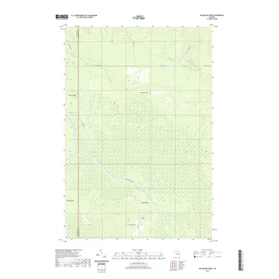
2019 Map of Big Beaver Creek
USGS Topo · Published 2019About this map
Young's Airport sits along W Maple Ridge Rd, providing a rare point of modern navigation in a landscape dominated by the complex hydrology of the Upper Peninsula. The drainage system is defined by the Tahquamenon River and its major tributaries, including the Hendrie River and the East Branch Tahquamenon River. These waterways meander through extensive wetlands, with Big Beaver Cr and Little Beaver Cr carving paths toward the larger river basins. In the northeast, Muckinaw Lake serves as a significant water feature near W Michigan Lake Rd. The map also documents the dividing line between Luce Co and Chippewa Co, following the path of S Hulbert Rd through the western portion of the quadrangle. This layout reflects the area's history of isolated rural transit, where roads like East-West Rd and Kallio Rd navigate around the saturated lowlands.
Find a feature on this map
22 named features on this map. Tap any name to fly to it.
Don’t see what you’re looking for? This feature index may not catch every label — zoom into the map to look around manually.
Map Details
Editions of this 2019 Big Beaver Creek Map
This is the sole edition of this map. No revisions or reprints were ever made.
Other maps of this area

1951 · Emerson
USGS Topo · 1:24,000

1951 · Piatt Lake
USGS Topo · 1:24,000

1951 · Big Beaver Creek
USGS Topo · 1:24,000

1951 · Hulbert
USGS Topo · 1:24,000

1951 · Eckerman
USGS Topo · 1:24,000

1951 · Timberlost
USGS Topo · 1:24,000

1951 · Eckerman
USGS Topo · 1:62,500

1951 · Shelldrake
USGS Topo · 1:62,500

1954 · Sault Sainte Marie
USGS Topo · 1:250,000

1956 · Sault Sainte Marie
USGS Topo · 1:250,000