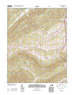
2013 Map of Big Bend
USGS Topo · Published 2013About this map
Walker Mountain and Little Walker Mountain dominate this part of Bland County, where the ridges of the Appalachian range dictate the layout of roads and settlements. The community of Bland serves as a focal point in the northeast, situated near Crab Orchard Lake and the headwaters of Town Creek. To the west, the winding course of Walker Creek connects Effna and Eagle Oak, following the valley floor between the high peaks.
Find a feature on this map
44 named features on this map. Tap any name to fly to it.
Don’t see what you’re looking for? This feature index may not catch every label — zoom into the map to look around manually.
Map Details
Editions of this 2013 Big Bend Map
This is the sole edition of this map. No revisions or reprints were ever made.
Other maps of this area

1887 · Pocahontas
USGS Topo · 1:125,000

1889 · Wytheville
USGS Topo · 1:125,000

1891 · Pocahontas
USGS Topo · 1:125,000

1892 · Wytheville
USGS Topo · 1:125,000

1894 · Pocahontas
USGS Topo · 1:125,000

1895 · Pocahontas
USGS Topo · 1:125,000

1930 · Speedwell
USGS Topo · 1:62,500
1935 · Nye Cove
USGS Topo · 1:24,000
1935 · Garden Mountain
USGS Topo · 1:24,000
1935 · Groseclose
USGS Topo · 1:24,000