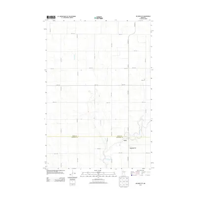
2013 Map of Big Bend City
USGS Topo · Published 2013About this map
The Chippewa River carves a winding path through the southern portion of this region, joined by the meandering course of Cottonwood Creek. The settlement of Big Bend City sits just east of this river junction, while the community of Hagan is situated slightly to the north along Co Hwy-17. This landscape is defined by the transition between the rolling river valley and the rigid grid of the surrounding agricultural prairie, which is partitioned by numerous rural routes including 100th St SW and 90th Ave SW. Genealogical interest is anchored by the W Bank Cem, located on a rise overlooking the river basin. The map clearly delineates the border between Swift and Chippewa counties, which runs horizontally through the center of the survey area, cutting across the natural drainage patterns of the local creeks.
Find a feature on this map
27 named features on this map. Tap any name to fly to it.
Don’t see what you’re looking for? This feature index may not catch every label — zoom into the map to look around manually.
Map Details
Editions of this 2013 Big Bend City Map
This is the sole edition of this map. No revisions or reprints were ever made.
Other maps of this area

1953 · Saint Cloud
USGS Topo · 1:250,000

1957 · Saint Cloud
USGS Topo · 1:250,000

1958 · Saint Cloud
USGS Topo · 1:250,000

1958 · Milan
USGS Topo · 1:24,000

1958 · Big Bend City
USGS Topo · 1:24,000

1958 · Watson
USGS Topo · 1:24,000

1958 · Milan NW
USGS Topo · 1:24,000

1958 · Gracelock NW
USGS Topo · 1:24,000

1958 · Gracelock SW
USGS Topo · 1:24,000

1968 · Danvers
USGS Topo · 1:24,000