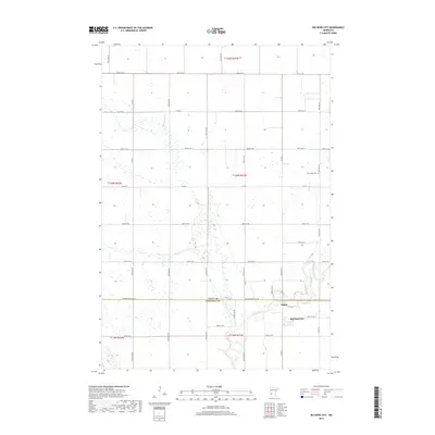
2019 Map of Big Bend City
USGS Topo · Published 2019About this map
The Chippewa River meanders through the southeastern portion of this landscape, carving a distinct valley near the small settlement of Big Bend City. This rural area at the border of Swift and Chippewa Counties is defined by its agricultural grid and the natural drainage patterns of Cottonwood Cr. The map captures a quiet stretch of the Minnesota prairie, where the hamlet of Hagan sits just north of the river bend. Local genealogy and history are preserved at the West Bank Cem, located along the eastern edge of the survey area. The intersection of local county roads, such as Co Rd 8 and Co Rd 6, highlights the enduring transport network that connects these scattered farmsteads and small communities.
Find a feature on this map
39 named features on this map. Tap any name to fly to it.
Don’t see what you’re looking for? This feature index may not catch every label — zoom into the map to look around manually.
Map Details
Editions of this 2019 Big Bend City Map
This is the sole edition of this map. No revisions or reprints were ever made.
Other maps of this area

1953 · Saint Cloud
USGS Topo · 1:250,000

1957 · Saint Cloud
USGS Topo · 1:250,000

1958 · Saint Cloud
USGS Topo · 1:250,000

1958 · Milan
USGS Topo · 1:24,000

1958 · Big Bend City
USGS Topo · 1:24,000

1958 · Watson
USGS Topo · 1:24,000

1958 · Milan NW
USGS Topo · 1:24,000

1958 · Gracelock NW
USGS Topo · 1:24,000

1958 · Gracelock SW
USGS Topo · 1:24,000

1968 · Danvers
USGS Topo · 1:24,000